Showing posts with label Dinosaur National Monument. Show all posts

Sunday, July 12, 2020

C1696
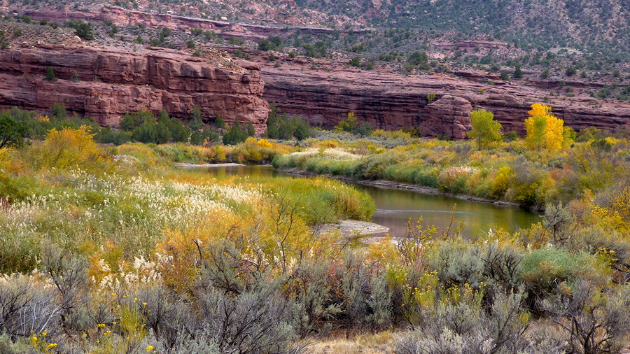
“Green River Reverie”
(Dinosaur National Monument, Utah)
Oil on Pannelli Telati fine cotton Panel
6”  x  8”


Imprimatura & Drawing

Block-in 

The Green River arises in the northern end of the Wind River Range in western Wyoming, first briefly flowing northwest, then loops out of the mountains to flow south along their western edge. It continues through western Wyoming, cutting the Flaming Gorge south of the town of Green River (where those of you familiar with the works of Thomas Moran will recognize the buttes and bluffs in some of his paintings). It enters Utah at the south end of the Flaming Gorge, turning east as it is blocked by the Uinta Mountains, flows into Browns Park, in extreme northwestern Colorado (definitely in Butch Cassidy country here), until it cuts through the eastern extension of the Uintas, at the Gates of Lodore. We are now in the northern section of Dinosaur National Monument. Rafting trips begin here. It now flows through deep canyons in the Monument, past the campground at Echo Park, near its junction with the Yampa River (an interesting descent of 3000” by car to get to), flows westerly from here, back into Utah and the western end of the Monument (Dinosaur National Monument, straddles the Utah/Colorado  border).

It is here where I came up on this quiet scene, not far from its egress at Split Mountain, and less than a mile or so below the Green River Campground. I have thought about painting this ever since my few brief moments here. I passed this spot several times in my explorations of this end of the Monument, and this time the lighting was just perfect. The contrasts of the purples and blues of the shadowed canyon wall (with its dark streaks of desert varnish), with the yellows, oranges and greens of the foliage, and the milky jade greens of the River itself, has stayed in my mind since those days I spent in the area in Autumn of 2017.  I stayed one night in the Green River Campground,  and it is quite pleasant as far as campgrounds go, with the River quietly flowing past. I spent the next 8 nights dispersed camping just outside the Monument on BLM land. The dinosaur bones are what bring most people to this monument, but if you are interested in geology and hiking intersting landscapes, Dinosaur National Monument is an interesting area to explore.

From here the Green winds south through eastern Utah, until its meeting with the Colorado River in Canyonlands National Park. I did not see the source of the River, but I could see the Canyon of the source south from where I camped at Mosquito Lake up on Union Pass, after I witnessed the  2017 eclipse of the Sun. I travelled the length of the Green through western Wyoming; saw it in Browns Park; saw it enter the Gates of Lodore; enjoyed the cooling shade of the cottonwoods for awhile at Echo Park; witnessed its emergence at Split Mountain; and enjoyed this little scene near the Green River Campground. I am not familiar with the River between here and Canyonlands NP, but I did see it from high places in Canyonlands, and just like not seeing the actual souces, I did not see its endgame, but I did see the canyon junctions where it joins its waters to the Colorado, from a distance. There are rivers that stay in the mind, and this is one ... I would see it again, should I ever go that way.

Pigments used in the painting were:
Imprimatura & Drawing: Rublev French Red Ochre;
Pigments: W&N Cadmiums Orange & Yellow Pale, Ultramarine Deep Blue, Titanium White;
Rublev:  Blue Ridge Yellow Ochre, French Red Ochre, Lead White #1;
Schmincke: Caput Mortuum;

Monday, November 6, 2017

Dinosaur National Monument to Mesa Verde … No Autumn Aspens in Colorado!

(Take Note: for those of you who have signed up to be notified by email of new postings to this blog, you have been receiving not just a notification, but an actual copy of the new blog posting as the email.  As this does not show the images of the paintings in the best possible light, you should click on the title of the latest blog posting at the top of the post, and not the title of the painting itself; this will open up the actual blog itself, and you may then enjoy the paintings at their best.)

Wednesday, October 18th_Friday, the 20th, 2017; Dinosaur National Monument to Mesa Verde.

Here is another painting I did last Winter in England.

C1621
“The Calm before the Storm …Gulls Rising over Kingsgate Bay”
(Isle of Thanet, Kent, England)
Oil on Centurian Oil Primed Linen Canvas
5” x 7”


On through Dinosaur, turning south through Rangely, both of whose lights I had been seeing of an evening for the past four nights, and on through Grand Junction, to Hwy 141 and Unaweep Canyon a few miles beyond.  Well, not exactly quickly through Grand Junction, for I had ascertained before leaving my clifftop camp above Dinosaur that if I got to Grand Junction by 13:30, I could catch a showing of “Bladerunner 2049.”  And so I did.  It is not as revolutionary a Sci-Fi film as the first one all those years ago, but it creditably continues our look at the Bladerunner universe.  I will say this that it is a long film, but I sat through the whole thing without a fidget, and was surprised at the time when I looked at my watch as the credits rolled (I did not  know its length when I sat down).  The first film is still one of the few true Sci-Fi films that there are, ‘Alien’ and ‘The Terminator’ being another two.  Horror and Fantasy get lumped in with the genre, but they shouldn’t be; they are their own entities.

Hwy 141 on the way down the Divide Road
from the Uncompahgre Plateau.

At Seep Springs in Unaweep Canyon.

At Gateway and the end of Unaweep Canyon,
and on into the Delores River Canyon.

After the film and a bit of resupplying, it was getting on towards sundown by the time I got twenty some miles into Unaweep Canyon, so I took the next forest road on the left (Divide Road), and as I did so I saw a truck on a ledge high above me … good grief, I thought, I’ve got to go way up there!  It was not a difficult drive, as it turned out, but a bit wash-boardie here and there, and the views from the ledge were spectacular … when I could take my eyes off the road to take a look.  And there was an inordinate amount of traffic coming down off the Uncompahgre Plateau.  Twenty eight vehicles passed me going down by the time I got into the National Forest and a campsite amongst the Ponderosas.  Normally I would have encountered two or three, or even none.  Upon nearing my eventual campsite, I spotted a sign in the dusk, informing all that there was a controlled burn in progress.  After I settled into camp, more vehicles passed by on the road, most heading out, and a very few heading in.  There was a bit of smoke in the air, but since most of the vehicles were leaving, I figured the controlled burn must have burned down.

In the Delores River Canyon.


Beastie.

The next day it took me six hours to make the hundred or so miles through Unaweep Canyon, and along the Delores River Canyon beyond the community of Gateway, as the photo-ops seemed to present themselves every few yards; red canyon walls contrasted with the green of the Junipers & Sage!  I hope I got some good shots as it was a mostly overcast day, although with some sunbreaks.  Once past Norwood, I thought I would find an early campsite, but I ended up on this interminable gravel road, with small ranches wall to wall and no public land for 17 miles, dropping down into and climbing out of two deep canyons along the way, before I found a campsite inside the National Forest on the northern slopes of Lone Cone, the westernmost mountain of the Colorado Rockies.  I was in a forest of dead Aspens, or so it seemed, since there was not one golden autumn leaf on any tree that I could see.  The Aspens had been in their prime when I left Grand Teton National Park, several degrees of latitude north, but down here in southern Colorado they had already turned and been blown off!  In 2013, at almost exactly this same time of the year, the Aspens had been in their prime, when I passed through not so far from where I now was.  At least the Cottonwoods had been stunning during this days drive … so to hell with the Colorado Aspens.

North Slope of Lone Cone Mountain …
no Autumn Aspens in Colorado …
I left them all in Wyoming this year.

Main Street Telluride.

Telluride is up at …

… the head of this valley.
The next day I refused to retrace my route along that gravel road, but took a different one north to the Highway, east of Norwood.  Here I did overlap the previous afternoon’s route, for 5 miles or so, but I was on blacktop.  I breakfasted in the campground I should have stopped at, but I had assumed it would have a charge, but I discovered too late that it did not.  Chalk it up for future reference.  I arrived in Telluride about 11:30, just to see the town, not knowing anything about it.  It has a really beautiful setting near the head of a canyon, with stunning peaks all around.  The town itself seems really laid back, almost hippie-esque, much more accessible than Aspen appeared to be.  I asked about how the snow compared to Aspen or Vail, and was told there was little difference, but that the ski runs were much steeper.  Another native said that it appealed to 20 year ski bums who liked to point their skis downhill and hang on for dear life.  I think if I had been able to afford to take up skiing when young Telluride would have appealed to me, but I went to England and an art career instead.  Telluride, so I have been told was the site of Butch Cassidy’s first bank robbery … that boy got around … I’ve been running into him all over since I headed up for the Eclipse.

Sheep Mountain on Hwy 145.

Yellow Mountain is across Hope Lake from Sheep Mountain.

Yellow Mountain from the top of the pass.

The Lizard Head.

Hwy 145 from Telluride to Cortez and Mesa Verde is one of the great mountain drives, and if you have ever drunk a can of Coors, you will recognize one of the views.  And here at Mesa Verde National Park I finally have been able to dispense with my long-johns for the first time since September 15th!  It is chill at night, and there has been a vicious wind building up during the days, but it is warmer than northern Wyoming.


Imprimatura: Rublev Italian Burnt Sienna;

Drawing: W&N Cobalt Blue;

Painting: W&N Cobalt & Cerulean Blues, Venetian Red; Rublev Blue Ridge Yellow Ochre, Italian Burnt Sienna, Lead Whites #1 & #2.

Monday, October 30, 2017

South to Dinosaur National Monument & Beyond

(Take Note: for those of you who have signed up to be notified by email of new postings to this blog, you have been receiving not just a notification, but an actual copy of the new blog posting as the email.  As this does not show the images of the paintings in the best possible light, you should click on the title of the latest blog posting at the top of the post, and not the title of the painting itself; this will open up the actual blog itself, and you may then enjoy the paintings at their best.)

Friday, October 6th_Wednesday, the 18th, 2017; Yellowstone National Park to Dinosaur National Monument, Utah.

C1644
“Afternoon … Mount Moran”
(Grand Teton National Park, Wyoming)
Oil on Pannelli Telati fine Cotton Panel
6” x 8”

Sold

It was a nightmare getting my last post published, as I did it from my phone from my campsite on a cliff high above and a few miles away from Dinosaur, Colorado, the same campsite I occupied for a night back in August, as I explored Dinosaur National Monument on my way north for the Eclipse.  It may just be my favorite campsite of all just for the view, not to mention solitude.  It feels like being in Asgard (home of the Norse Gods), looking down on the earth below, especially in the evening when the lights of Dinosaur (ten miles distant) and Rangely, Colorado (twenty miles beyond that), twinkle on in the gloaming.  But I digress.  The nightmare of that posting was the hours spent trying to copy and paste from my Word document to my blog, and get the photos inserted, on the small phone screen … it took most of a day.   I’m probably going to have to cut way back on the photos in future.

The Drawing & Block-in stage of the painting.

On the Friday morning after leaving Yellowstone, I crossed into Idaho with the whole purpose of having my tires rotated at the Les Schwab Tire Center in St. Anthony, the closest Les Schwab I was likely to see for awhile, and I did need a rotation, and of course it would be free.  It was interesting to see the Tetons in the distance from their other side after so many days on the Wyoming side.   The tires were rotated by 11:30 and I was passing back through Jackson, Wyoming by mid-afternoon.  I found my campsite north of Pinedale at the south end of the Gros Ventre Range early enough to get supper cooked by dark.  This would be my last night in Grizzly country, after seven weeks and one day.

Big Horn Sheep in ...

... Sheep Creek Canyon, Flaming Gorge, Utah.
The next day I stopped off at the Mountain Man Museum in Pinedale, spending several hours there.  As I was leaving I was showing the ladies on the desk some of my small Oils, when a chap named Sam showed interest and ended up buying the one of the Pinnacles in the Afternoon at Brooks Lake.  Then on down the through Rock Springs & Green River, where I located the view that Thomas Moran had painted more than once, and on down the west side of Flaming Gorge to Sheep Creek Canyon just over the border into Utah.  Here I saw Bighorn Sheep, a first for me.  I also decided to spend the night here amongst the Gold of the Autumn Cottonwoods.  The afternoon light was wonderful.  Who knew that three hours later it would be snowing while I was having my after dinner hot chocolate!  And I thought I was leaving the snow behind for awhile!!  Incidentally, the Thomas Moran viewpoint is pretty seedy these days, with railroads and small industries past their prime clogging the view.  It would be an interesting exercise painting it, retrieving the natural scene without the modern clutter. 

I awoke (07:23), looked out and saw a ram & 5 ewes of Bighorn Sheep passing just in front of the truck.  I watched them as they gamboled through the campground … a couple of the ewes would do these stiff legged leaps straight up on occasion, like domestic lambs I’ve seen … pretty funny stuff.  The snow began melting off with the Sun of morning, and I took the Sheep Creek Canyon geological loop drive, which is signposted with the various layers of strata as they appear along the road.  I crossed over the Uinta Mountains, which is made up of the oldest rocks in this part of Utah, and is also the only east-west mountain range in the country.  By evening I was in the western sector of Dinosaur National Monument; you will remember I passed through the eastern part of it on my way north to the Eclipse two months before.  I camped that night in the Green River Campground.

On the Green River, Dinosaur National Monument.
The next day I visited several sites, beginning with Josie Morris’s cabin at the end of the road.  She lived there alone for fifty years, passing away at age 91.  In her younger days she was acquainted with the outlaw Butch Cassidy.  About three quarters of a mile before the cabin the road forks and the right fork is signposted for 4-wheel drive and high clearance only.  I found that it leads to BLM land and that the road eventually climbs onto Blue Mountain and Point of Pines where I had camped back in August, but I did not make that climb just yet.


Josie’s Cabin.


Box Canyon where Josie corralled her cattle.
I camped for four nights on the way to the mountain, after going to the Quarry, where you may see a raft of Dinosaur bones still embedded in the rock.  This boneyard has been enclosed in an exhibition hall to protect the bones, in situ, from the elements.  The following are photos of Dinosaur bones at the Quarry.


Brontosaurus Skin Impression.


I remained in camp after that completing two paintings I had begun in Grand Teton National Park.  Finally I made the desperate climb up to my old campsite at Point of Pines.  The road is one of the steepest dirt roads I have ever been on, and there is no respite once you begin the climb, for it does not ease off until you have reached the top of the four mile climb.  I easily found my cliff top campsite, which was less than five miles distant from my previous camp.  I remained there for four nights, and is one of my favorite campsites of all time.  I worked on processing my photographs and other PC work, and my last blog post which was so infuriatingly time consuming to post.  But post it I did, and during each day I camped there I drove out to some of the places on the Harpers Corner Road I had visited in August, including the two mile trail at the end of that road, 3000 feet above Echo Park, and the confluence of the Green and Yampa Rivers. 

Evening looking East from my valley campsite.

Morning looking Southwest from camp.

Canyon Corral.

The Elephant Toes.
Finally on Wednesday, the 18th, after nine days in Dinosaur National Monument, I made my way the nine miles to the Harpers Corner Road, headed towards the town of Dinosaur, but after another nine miles turned west onto County Road 16 (the Miners Draw Road), which after 24 miles in total, took me down beneath my Point of Pines camp, now only a couple miles distant, but a couple thousand feet above.  On the way down I startled a Pronghorn, who ran down the road before me for a half, maybe, three quarters of a mile before turning off the road … at times she was going about 30 mph.  This road took me through Snake John Reef (which sinuous geological feature I had been looking at for four days), to Hwy 40, and once on the pavement, through the Reef a second time as I headed to Dinosaur from the west.  Snake John Reef is made up of three layers of late Cretaceous strata rising gently from west to east, breaking the surface of the later alluvial soils, and representing an ancient coastal shoreline.  I do not know the origin of its name … no doubt there’s a story there.

Snake John Reef in the center
from my cliff-top campsite.

Sunset at Point of Pines …

… and in the valley below.
The lights of Dinosaur, about 10 miles distant,
with those of Rangely another 15 miles beyond.
Snake John Reef from on the way down
Miners Draw Road …

… and closer …

… and closer still.
… and at the cutting on US Hwy 40.

Imprimatura: Rublev Ercolano Red;

Drawing: Ercolano Red for the foreground foliage, & W&N Cobalt Blue for the mountain & distance;

Painting: W&N Cobalt and Cerulean Blues, Cadmiums Orange & Yellow Pale;

Rublev Blue Ridge Yellow Ochre, Ercolano Red, Purple Ochre, and Lead White #1 & 2.

Friday, September 15, 2017

North to Wyoming: Part 2

(Take Note: for those of you who have signed up to be notified by email of new postings to this blog, you have been receiving not just a notification, but an actual copy of the new blog posting as the email.  As this does not show the images of the paintings in the best possible light, you should click on the title of the latest blog posting at the top of the post, and not the title of the painting itself; this will open up the actual blog itself, and you may then enjoy the paintings at their best.)

Monday, August 14 - August 21, 2017; Dinosaur National Monument, northwest Colorado & northeast Utah, and on to west of Union Pass, Wind River Range, Wyoming.

I had no time between leaving Aspen, CO until after the Eclipse to paint, so this is another painting done after that event, but this blog post is of part of the journey to arrive there.

C1633
“Wildfowl Flotillas on Mosquito Lake”
(West of Union Pass, Wyoming)
Oil Sketch on Centurian Oil Primed Linen Panel
5” x 7”


I ended part 1 of Heading north to Wyoming with; “And that was Thursday, day two of the Dinosaur National Monument, where I thought I would spend only part of one day to breeze through!”

And yet, I was not yet finished with the Monument, for how can you pass up a name such as ‘the Gates of Lodore?’  Sounds like something from ‘the Lord of the Rings.’  To get there, in the morning I continued on the county roads for thirteen miles to Us Hwy 40 at Elk Springs (a couple houses and a rest area), and on to Maybell and a petrol station.  From here State Hwy 318 is followed west forty miles or so (now north of the Yampa River), and then leaving the pavement, a gravel road is taken a few miles to the Gates of Lodore where the Green River enters the mountains.  It’s funny to think that just a few miles by river will take one to the meeting of the Yampa River with the Green at Echo Park, where I was yesterday, so many desperate road miles ago; there were two groups of rafters preparing to do just that.  The views of the Gates from the sand bank on the Green at the campground are good, but for the classic views of the river into the canyon itself, a mile stroll along a nature trail is well worth the hike.  Sadly the box containing the guides to the numbered points of interest was empty.  You know … I never spotted one Dinosaur the whole time I was in Dinosaur National Monument!  I, of course, expected them lurking on every horizon.  What a swizz (that is a ’jip,’ to the Yanks out there!!  Har! Har!

The Gates of Lodore from the Campground.

The Gates from the Nature Walk.

The Gates of Lodore from Trail’s End.

Into the Gates.

Floaters on the Green.
Now wasn't that really Lord of the Rings-ish?  Photos taken and lunch eaten, and I continued west on Hwy 318.  A few miles along from the Gates of Lodore, I attempted to cross the Green, to drive the few miles to one of the hideouts of Butch Cassidy, but the bridge has been closed to vehicle traffic, and an eight mile walk was not in my timetable.  From the highway one could see the canyon, and imagine the seclusion of the place, especially back then.

A few miles along from the Gates of Lodore,
one comes to Browns Park National Wildlife Refuge.

Near Browns Park Butch Cassidy had one of his hideouts across the Green River.

Up that valley, is one of Butch’s hideouts;
The Green is in the fold of land between here and there.


A few miles along the road enters Utah, and the pavement ends and becomes gravel and intermittent with pavement for the forty or so miles to its junction with US Hwy 191, which I took north through Rock Springs, Wyoming, topping up with petrol and ice, to Farson.  Turning northeast here onto State Hwy 28, forty miles brought me to the famous South Pass.  Here this broad pass, at the south end of the Wind River Range, saw thousands of emigrants pass through on the Oregon Trail, including the Mormons on their 1847 trek to the future Salt Lake City.  One can still see the wagon ruts in places.  A few miles on I left the pavement for the forest roads, and five miles in, camped for the night, on forest road 309.

Just to the west of South Pass is the “Parting of the Ways.”

At South Pass.

South Pass is at the top of the ridge to the left of Pacific Butte.

Of course I had to show you Oregon Buttes, which lie to the south of Pacific Butte.

To the north of South Pass is the Wind River Range,
and at their north end is where I watched the Eclipse,
three days after I passed through South Pass
 and up the east side of the mountains,
through the town of Dubois, and then over Union Pass.

More historical info at South Pass.
The next day, Saturday, I passed through Lander, on US287, stopped into the ranger station there, picked up some free eclipse info and eclipse glasses, topped up with petrol, and continued on to Dubois, seventy miles further.  Here I strolled around this decidedly western town (with hitching posts in places), topped up with petrol again, and a bit of dry ice to make my normal ice keep longer, and headed into the Wind River Range over Union Pass, and the eclipse in two days time, and that you already have read about in my last posting.

Red Canyon overlook, on the east side of South Pass.

Wildlife info.